

A Practical Guide to MEP Reality Capture
This guide to MEP reality capture explains how LiDAR, 360 imaging, and Scan-to-BIM reduce clashes, speed decisions, and improve retrofit planning on site.
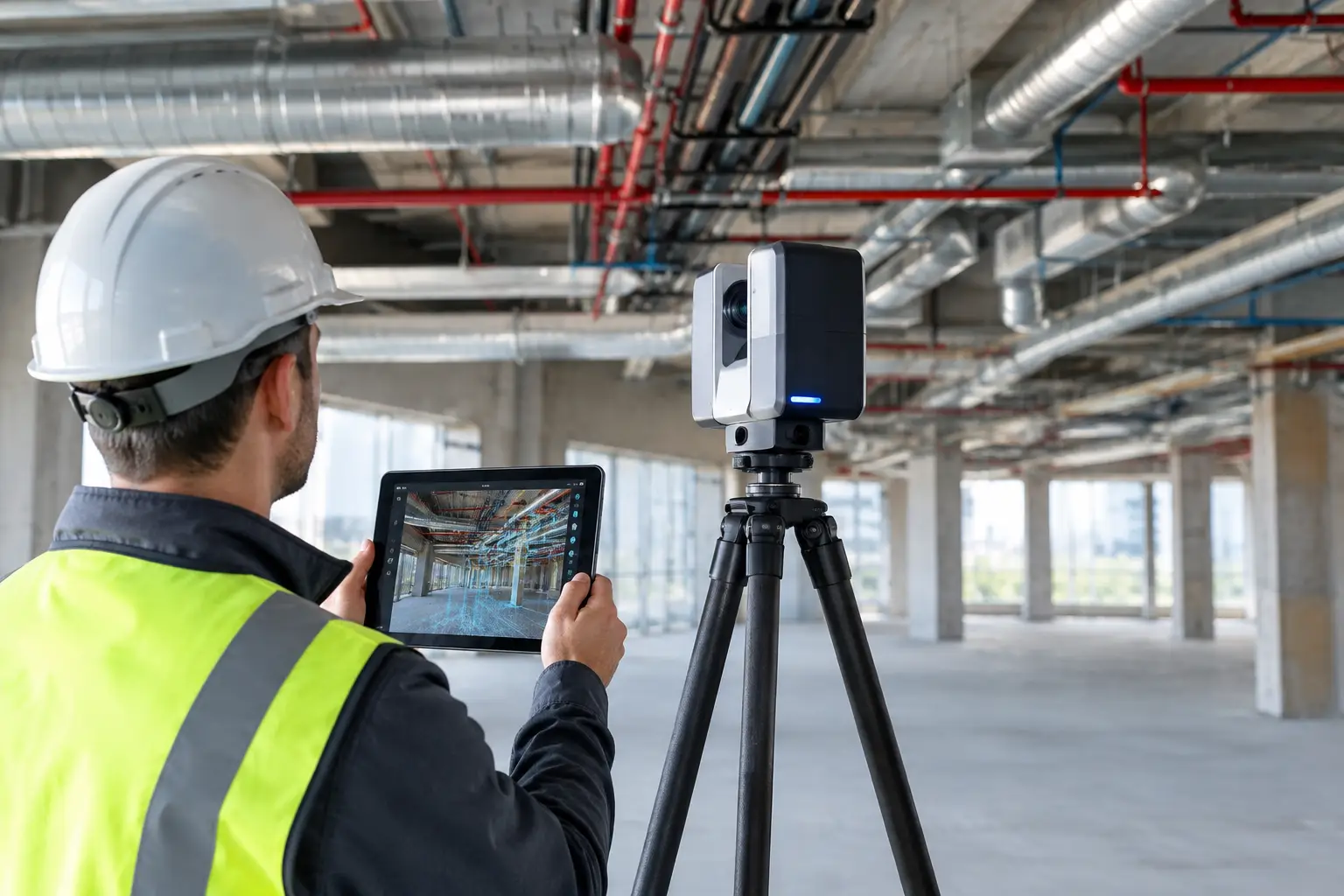
This guide to MEP reality capture explains how LiDAR, 360 imaging, and Scan-to-BIM reduce clashes, speed decisions, and improve retrofit planning on site.
A Practical Guide to MEP Reality Capture
A ceiling is closed, a riser is inaccessible, and a renovation team discovers that the existing duct route sits 150 mm lower than the drawings suggest. That is where a guide to MEP reality capture becomes commercially relevant. Accurate spatial data gives engineers, contractors, and facility teams a dependable record of what is actually installed – before design assumptions become site delays, rework, or change orders.
MEP reality capture uses technologies such as terrestrial LiDAR scanning, 360-degree imagery, photogrammetry, and Scan-to-BIM workflows to document mechanical, electrical, and plumbing systems in their real-world context. The objective is not simply to create an attractive 3D model. It is to produce usable evidence that supports coordination, retrofit design, asset planning, remote review, and more confident decisions.
What MEP reality capture documents
Traditional as-built documentation is often incomplete, outdated, or based on redline markups that never made it into final drawings. Reality capture addresses that gap by recording the space itself: pipework, conduits, cable trays, ductwork, plant rooms, shafts, ceilings, equipment clearances, and structural constraints.
A high-quality capture program combines geometry with visual context. LiDAR point clouds provide measurable spatial accuracy, while 360 imagery helps project teams identify labels, valve types, panel conditions, access limitations, and installation details that may not be clear in a point cloud alone. The right deliverable depends on the decision being made. A facilities team may need a navigable digital twin and tagged asset information, while an engineering consultant may require a registered point cloud or an LOD-specific BIM model for coordination.
This distinction matters. A scan does not automatically become a useful engineering model, and a polished virtual walkthrough is not a substitute for survey-grade geometry. The capture method, level of detail, and validation process should match the project risk.
When MEP capture delivers the most value
MEP reality capture is especially valuable when existing conditions are difficult to verify. Renovation and fit-out projects are a common example. Buildings evolve through tenant changes, maintenance work, and undocumented modifications. The mechanical room may no longer match the record drawings, or a ceiling void may contain layers of services added over decades.
It is also highly effective before equipment replacement. When replacing an AHU, chiller component, switchboard, pump, or production line, the team needs more than equipment dimensions. They need to understand the removal path, access doors, structural openings, surrounding services, maintenance clearances, and potential shutdown impacts. Capturing these conditions early can prevent a procurement decision from creating an installation problem later.
For occupied facilities, remote access is another benefit. Stakeholders can review a plant room or technical space without repeatedly coordinating site visits. This is useful for regional owners, consultants, and suppliers working across Malaysia, Singapore, Indonesia, and Thailand, where travel and site access can slow approval cycles. Remote review does not eliminate the need for physical inspections in every case, but it reduces unnecessary visits and makes each visit more focused.
A guide to MEP reality capture workflow
The most reliable projects begin with a clear question: what must the team know after capture that it cannot confirm today? That question determines the scope, technology, and final outputs.
Define decisions before defining deliverables
Start with the intended use. Is the data needed for clash detection, design of a new fit-out, construction verification, facility management, or a digital archive? A point cloud suitable for general visual reference may not be adequate for fabrication coordination. Likewise, modeling every visible bracket and fitting can add cost without improving the decision at hand.
Agree on the required accuracy, coordinate system, coverage areas, and model level of development early. For a multistory commercial asset, teams should also establish floor naming, room references, plant identifiers, and file conventions. These details appear administrative, but they determine whether information can be used efficiently by design, construction, and operations teams.
Plan for access, visibility, and live conditions
MEP systems are often hidden behind ceilings, inside shafts, or in plant rooms with limited access. A scanner can only record surfaces it can see. Closed ceiling spaces, dense services, reflective metal, glass, water, and active industrial environments all affect capture quality.
The site plan should identify restricted zones, equipment that must remain operational, safe scanning positions, and areas where access panels or ceiling tiles can be opened. Capturing while the building is active may be necessary, but moving people and equipment can create temporary obstructions. In some cases, a short off-hours capture window produces a cleaner and more complete dataset.
Capture geometry and visual evidence together
LiDAR is the core technology for dimensional understanding. It collects millions of measured points to create a point cloud that represents surfaces and spatial relationships. Multiple scan positions are registered into a common dataset, allowing teams to measure routes, elevations, clearances, and equipment locations.
360 imagery adds practical context. Engineers can inspect the visual condition of equipment, read signage where image resolution permits, and understand how services are arranged in the room. Drone imaging can support exterior plant areas, rooftops, and large industrial sites, although it is not a replacement for terrestrial capture of detailed interior MEP systems.
A professionally planned capture sequence reduces blind spots. The goal is not to maximize the number of scans. It is to obtain complete, correctly aligned coverage of decision-critical areas.
Process, verify, and model to the agreed standard
After field capture, point clouds are registered, cleaned, and checked for alignment. Quality control should confirm that coverage is complete and that control points or reference measurements meet the project accuracy requirement. If data will be used in BIM software, it should be delivered in formats compatible with the project team’s workflow.
Scan-to-BIM modeling then translates the point cloud into intelligent geometry. Modelers trace and classify relevant systems, such as ducts, pipe runs, trays, fixtures, equipment, and structural interfaces. This is where scope discipline is essential. Modeling hidden systems that were not captured requires assumptions, and those assumptions must be clearly identified rather than presented as fact.
For renovation or coordination work, teams often model the elements that affect design and installation. For facility management, the priority may shift toward equipment assets, room data, and maintainable system records. Novo Reperio approaches this as a data-use decision, not simply a visualization exercise.
Accuracy, level of detail, and the cost trade-off
Higher precision and deeper modeling can improve coordination, but they require more time in the field and more processing effort afterward. The right balance depends on the cost of getting it wrong.
A preliminary feasibility study may only need enough information to confirm equipment space and primary route constraints. A hospital renovation, data center upgrade, or tightly coordinated commercial fit-out may justify denser capture, stronger control, and a more detailed BIM output because clashes carry greater cost and operational risk.
Teams should also separate capture accuracy from model accuracy. A point cloud can be captured to a high standard, but a simplified model will intentionally omit detail. Conversely, a detailed-looking model may not be reliable if it was created from incomplete scans or unverified legacy drawings. Ask how data will be checked, what is included, what is excluded, and where assumptions have been made.
Turning captured data into project outcomes
The strongest MEP reality capture programs do not end with a file handover. The data should be structured so it can move through the project lifecycle. Design teams can reference point clouds during layout development. Contractors can use them to review installation constraints. Owners can retain a digital record for maintenance planning, future tenant works, and capital improvement decisions.
A digital twin can extend this value by making spatial information easier for nontechnical stakeholders to access. Instead of searching through disconnected drawings and folders, an asset manager can navigate a familiar digital environment, view key spaces remotely, and connect documentation to physical locations. This is particularly helpful for portfolios where decision-makers need visibility across multiple sites.
That said, the technology is only as useful as the governance behind it. Establish who owns the data, where it will be stored, which teams can update it, and how future changes will be recorded. A digital record that is never maintained eventually becomes another version of the outdated as-built problem.
Questions to ask before commissioning a capture survey
Before appointing a provider, confirm whether they understand both spatial capture and the downstream MEP workflow. Ask what accuracy can be achieved in the proposed environment, how inaccessible areas will be handled, and how registration quality will be verified. Clarify whether the scope includes raw point clouds, registered point clouds, 360 imagery, BIM modeling, asset tags, or an interactive digital environment.
It is also worth asking how the team will coordinate with your design consultants and contractors. The best outcome comes when capture data is introduced early enough to influence design decisions, rather than being commissioned after a clash or variation has already occurred.
A well-planned MEP reality capture project gives every stakeholder a clearer starting point: not a guess about what lies above the ceiling or behind the plant-room door, but a measurable digital record that can support the next decision with confidence.